Goat Canyon Trestle


Update 01/28/2015:

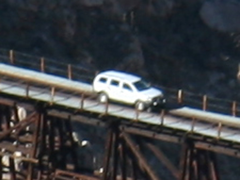
Be aware that the tracks are railroad  property. I have no idea what the easement is. We did a hike to Goat canyon. Climbed a hill on the southwest side of the canyon. There was a car on the Trestle. This is railroad police. They are law officers do not get that wrong. They can do everything law officers can do. These cars have fold down railroad wheels. You can see the one picture with the wheels in the front on the track. They have been actively citing individuals on the tracks.

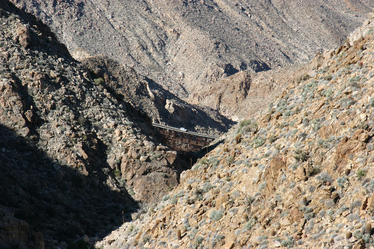
Back Packing to the trestle in Goat Canyon to the trestle. This is the worlds largest curved wooden trestle. Spanning 600ft long and 200ft high. The hike from Montero Palms to the trestle is no small task.  Don't be fooled into thinking that the 3 mile hike is an easy one. Be prepared for a work out! Bring lots of water you'll need it!  If your fit you may choose once your at the trestle to return the same way. Goat Canyon is a steep drop with many rock waterfalls. We elected to pack out along the tracks. Keep a sharp eye for those stacked rocks, these are trail markers. The hike will be broke down into 5 sections:

1- Through Montero Palms

2 - Incline up to the highest elevation

3 - Down into Goat Canyon

4 - Messing around the trestle

5 - Out the tracks.

1 - Montero Palms and the first mile. Starting Elevation 1955, Ending Elevation 2576. This leg of the trip you will be doing a lot of boulder climbing.

 doug1doug2doug3doug4doug5

doug6doug7doug8doug9doug10

doug11john1john2john3vern1

vern2vern3vern3vern4vern5

vern6vern7

2 - The second part of the hike is a gradual climb from 2576 ft to the highest elevation of 3282 ft. At 3282 you will have a flat area of about 1/8 mile before entering the downward trip into goat canyon. This section of the hike is 1 mile plus.

 doug1doug2doug3doug4doug5

doug6john1john2vern1vern2

vern3vern4doug5

3 - The third section of the hike is the best! Going into Goat canyon is spectacular! You really need to be a goat here. Theres rock water falls from 25 ft to about 100. If your scared of heights or don't rock climb well stay out. Death or serious injury can happen in here! Starting elevation is 3282 ft and drops to 2270 is about a mile.

This is terrific!

yeah!

Messing around the trestle. Why not? After that 3 1/2 hour hike, and actually arriving at the trestle in one piece it was time to  take a quick lunch and start snapping those shots proving you actually made it. The trestle is posted with signs of no trespassing from Union Pacific. We don't actually know if this warning is for all the track and or the bridge. We started at 9:30am and arrived at 1:00pm at the trestle!

Final goat canyon decent

A tall structure

The longest section of the hike is to begin. Its about 6 miles. Starting elevation is 2270 and ends at 1940. Started heading out at 1:30pm. This part of the hike out follows the tracks. Its a slight elevation inline/decline. The hike took a toll on us here, less talking and we staggered out a bit down the tracks. We finished at 4:00 pm. There was plenty of minor landslides along the track so we were not worried about any trains. There was many other hikers coming in along the tracks also that day.

looking back at 1.3 miles

Thats all..easy!

Garmin .gdb tracks from the Oregon 500 HERE

Google KML file HERE


Print